|
There are many nature parks in the area to visit
Cap de Creus (Llanca , el Port de la Selva, Cadaques y Roses).
Massis de Montgri (l'Escala, Bellcaire y
Torroella de Montgri).
Islas Medes (l'Estartit).
Massis de l'Albera (la jonquera, Cantallops y Espolla).
Aiguamolls
del Baix Emporda (Torroella de Montgra i Pals)
| CAP REUS |

|
Cap De Creus
The Cap
Creus is the last outlet of the Pyrenees and at the same time the most easterly point of the Iberian Peninsula on the map.
That is one of the reasons why the Cap with its lighthouse is a particularly important point in the nautical charts.
The
Cap Creus since May 1998 declared as a nature reserve, lies by the sea as well as on land. By the sea the area begins at the
land point of Bol Nou near the Cala Tamariu within the region of Port de la Selva and ends just before Roses at the land point
of (kat. Punta) Falconera. Fishing with nets is forbidden within this area, in some zones, however fishing in the traditional
way with staggered arrays or the " Palangre " is permitted. The protected area on land covers an space of scarcely 90 hectares.
Fauna and Flora are equally protected . The majority of the area, i.e. 40 hectares, lies within Port de la Selva.
| Montgri |

|
Torroella de Montgrí separates the bays of Roses, to the north,
and the Ter river, to the south. The municipality of Torroella de Montgrí, with the urban zones of el Castell, Ullà and l'Escala
lying at the foot of the mountain.
On the south side, the massif is delimited by the towns of Ullà, Torroella de Montgrí
and l'Estartit. To the west one finds the centres of l'Abolleria, Bellcaire and Sobrestany, and in the northern sector, l'Escala
and the zones of Riells and Montgó constitute the remaining foothills.
Strangely, the area included within the Pla d'Espais
d'Interès Natural, and therefore subject to protection by the state, is understood to be 3,042 ha.
The maximum altitude
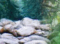
in the Montgrí group is that of Montplà (317 m), followed by Ullà (308 m) and el Castell (306 m). There are many caves but
most important is the Cau del Duc de Torroella, a paleolithic site situated on the southern slope, directly below the castle
that gives name to the massif. On the coast itself, in the area of Foradada, is a huge hole in the rock in the form of an
arch, large enough to allow boats to pass through.
| Aiguamolls |

|
Aiguamolls nature park
Our
region is rightly proud of its flora and fauna, and one of the finest venues is he protected areas of "Aiguamolls d'Empordà."
This wonderful park is available to the public free of charge. The park contains more than 4783 hectares between the Serra
de Rodes to the north and the delta of the Fluvia Vell to the south.The Aiguamolls are a regular stopping place for many species
of migrating birds.
| Isles Medes |

|
Isles Medes
Medes
Islands are an arxipèlag of 21,5 hac composed by some small islands situated 1 mile away from l'Estartit.
It's vegetation
and its fauna are worthy to be studied, Medas Islands have an exceptional value in the Mediterranean sea due to its marine
media. The proximity an the mouth of the Ter river, the influence of the winds and the running water plenty of organic contributions,
the depth of this floor, its composition, rocky or sandy, and the presence of large caves and tunnels are some of the reasons
why there are so many ambients and species living there.It's underwater floor is protected by law, but visits and recreational
activities are allowed not only by particular boats but also by rented boats. The protection law dicted in 1995 by the Generalitat
de Catalunya wich defined a fishing preserve area around the islands has been widened by the law 19/1990 about vegetation
and fauna which converts Medes Islands in the biggest and one of the most important acquatic natural parks in the whole Mediterranean
Sea.
Massis de l'Albrera
The
Albera is a mountainous massif situated at the eastern extreme of the Pyrenees, between the col of Pertús and the Marenda
coast., its areas are divided between Catalonia and France. The southern slope comprises an area of more than 10,000 ha, and
includes part of the border municipalities from la Jonquera to Portbou.
The historical and archeological heritage of the
Albera range is of great value, represented by over 100 megalithic monuments (dolmens, menhirs and necropolis) which are found
scattered throughout the area. Of architectural importance is the pre-romanic and romanic monastery of Sant Quirze de Colera,
which appears documented as early as the 10th century and of which the basilica and cloisters remain. Notable from the mediaeval
castles is Requesens, constructed in the 14th century. Situated north of the village of Cantallops, it towers over the thick
forests which cover the slopes of the Neulós peak. Civil and domestic elements such as mills, ice wells, bridges, shepherds'
huts and large farm houses complete the rich cultural heritage which gives us a clear insight into a large part of our country's
history.
http://www.gencat.es/mediamb/pn/espais/albera-ang.htm
|